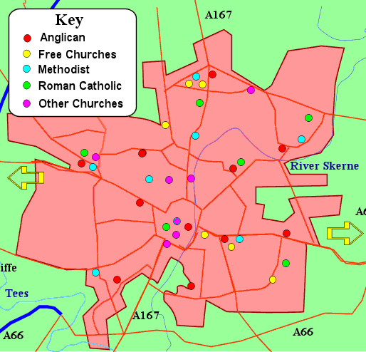
Map of Darlington Showing location of churches in the central part of the town
- Click on a dot in the key panel to fetch a list of churches by denomination.
- Hover the curser over a dot to see the name of the church
- Click on a dot on the map to fetch information about that church
- Click on an arrow to fetch maps of areas to the east or west of Darlington
- Note: the Parish of Hurworth, All Saints, with associated village churches at Sockburn, Low Dinsdale and Girsby lie just off the south of this map.